Planetary Boundary Layer (PBL) Showcase
The The lowest part of the atmosphere, usually 1 to 2 km deep, where air is stirred directly by the ground or ocean below and can change dramatically between day and night. (PBL) is the critical region extending from ground level to 1-2 kilometers above Earth's surface - understanding it is essential for weather forecasting, particularly since it's where human activity occurs. In this region, atmospheric conditions such as moisture, temperature, and winds can all change quickly through very localized processes of heat transfer, moisture exchange, and friction. Sampling the PBL is vital not only in populated areas but also in remote regions, as warm, moist air evaporating from oceans can travel thousands of miles before forming clouds and precipitation.
At WindBorne, we like to tinker and experiment with our Global Sounding Balloons (WindBorne's long-duration weather balloon, which changes altitude to steer and collects soundings around the world.) to push the limits of what’s possible. Whether it's new hardware or software design, we thoroughly test our changes to ensure they're scalable before rolling them out to our global balloon constellation. This rigorous testing approach helps us deploy updates in a safe and robust way. Our newest change is one we’re quite excited about: tuning our controller settings to fly our balloons further into the PBL, gathering previously inaccessible data at low altitudes in remote locations. We’re now consistently flying close to the earth and are able to collect data that can be especially valuable for more accurate forecasts.
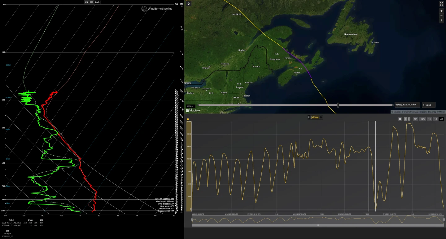
Managing a balloon in the PBL's turbulent winds and sudden condensation layers generally presents as a significant challenge, but our recent modifications allow us to take closer A set of measurements of temperature, humidity, wind, and pressure taken at different heights as an instrument moves up or down through the atmosphere. in these valuable altitudes. These flights can now routinely descend to low elevations - our record turnaround being 14 meters above the ocean! In our onboard flight software, a new PBL Mode will be more daring on descent, but quickly turn around if either high humidity or turbulence hazards are detected. Additionally, our ground control software now uses outputs from WeatherMesh to intelligently decide when the weather is safe enough to perform these deep soundings.
These changes continue to improve our cost and coverage compared to traditional weather data collection. At approximately $100 per sounding, our soundings are about 5x cheaper than A small instrument package carried up by a weather balloon that measures temperature, humidity, pressure, and wind and radios the data back to the ground, usually on a single ascent before bursting. and 50x cheaper than aircraft-deployed dropsondes when accounting for full operational costs. In their multiple weeks of flight, our GSBs fly to previously inaccessible locations while gathering dozens of complete vertical atmospheric profiles from the PBL to the mid-The layer above the troposphere, from about 10 to 50 km up, where the air is dry and stable and temperature rises with height..
We’ve been working hard to improve our GSB’s capabilities and are eager to surface more data about our planet.
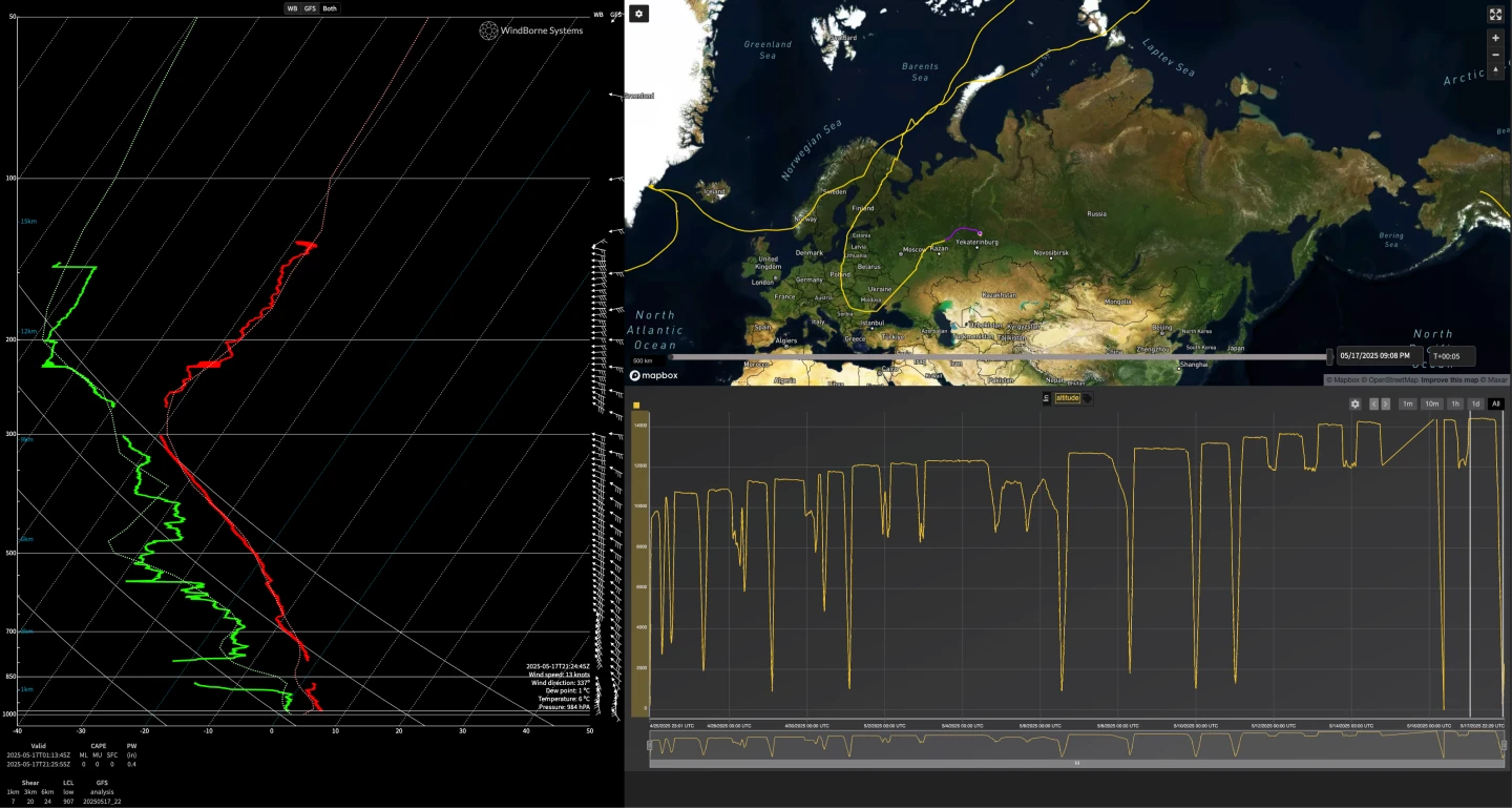
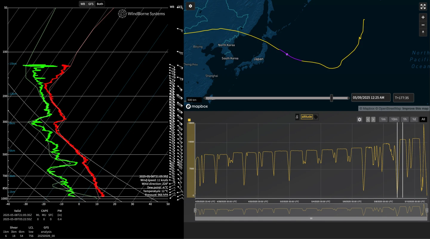
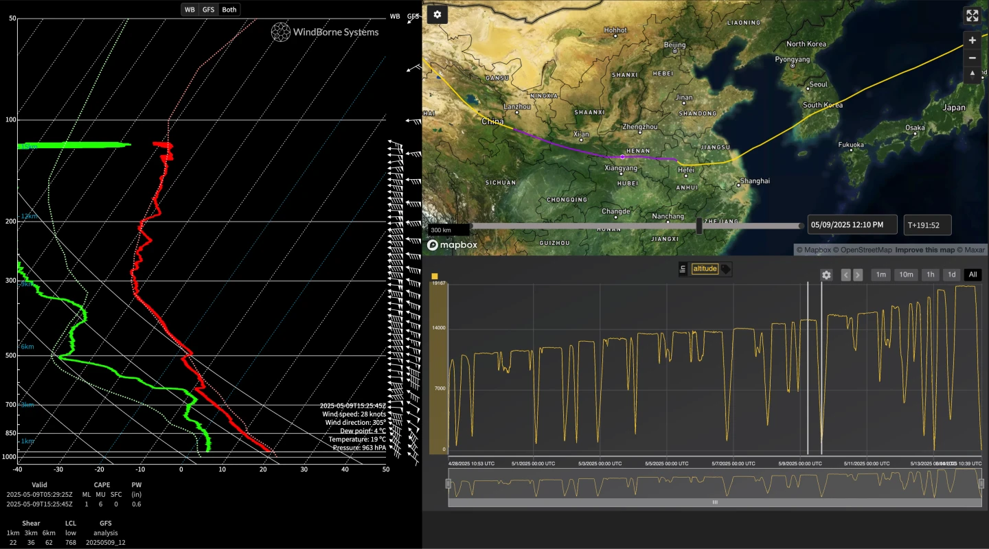
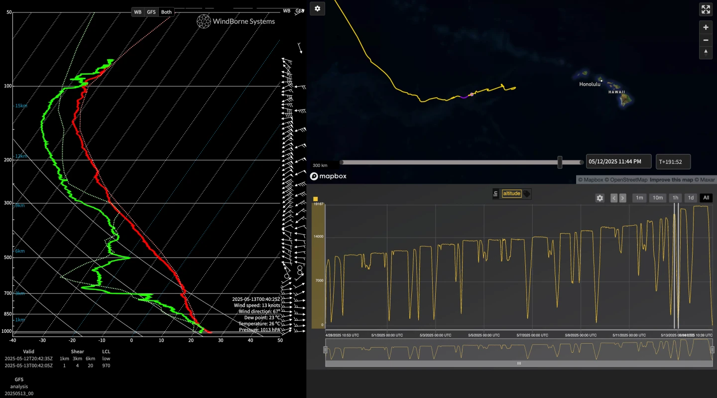
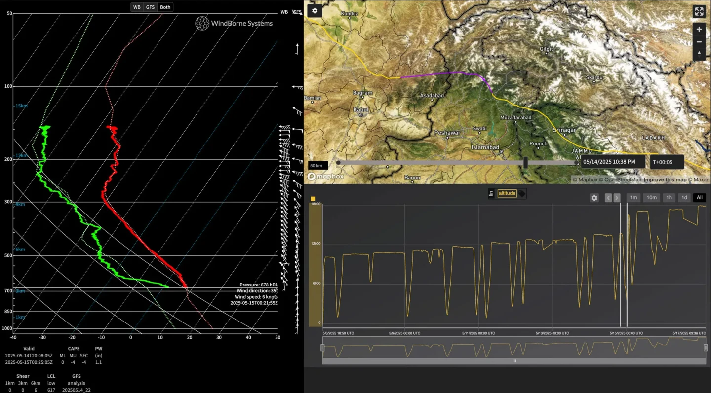
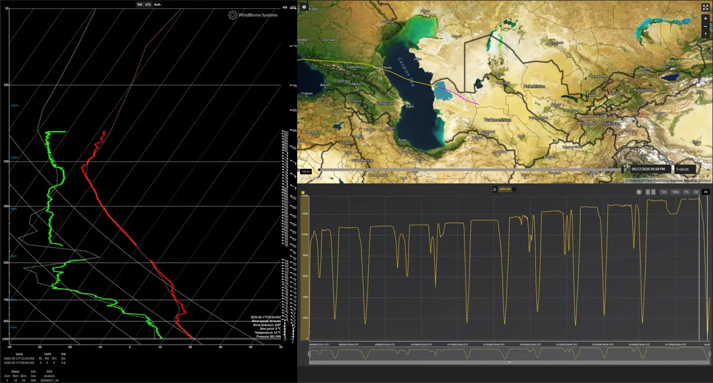
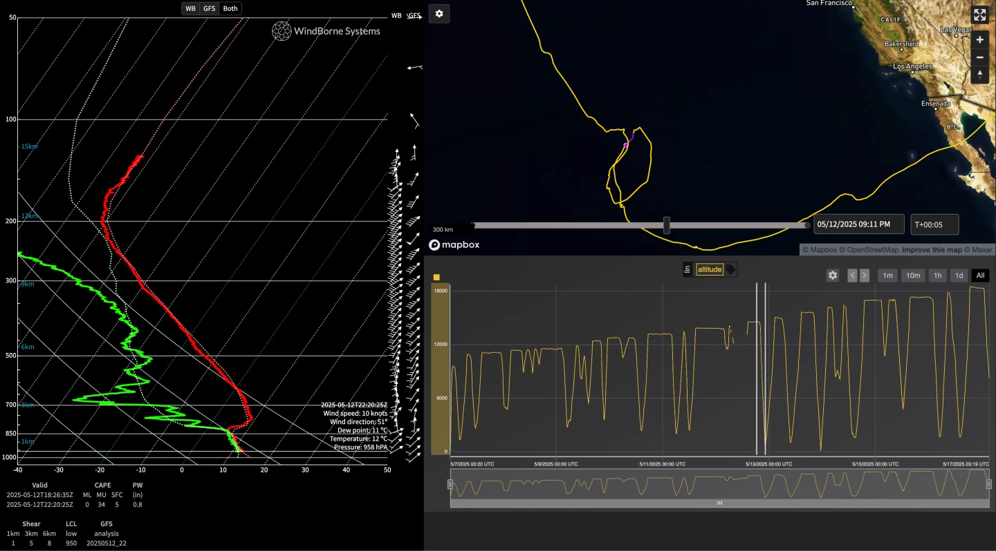
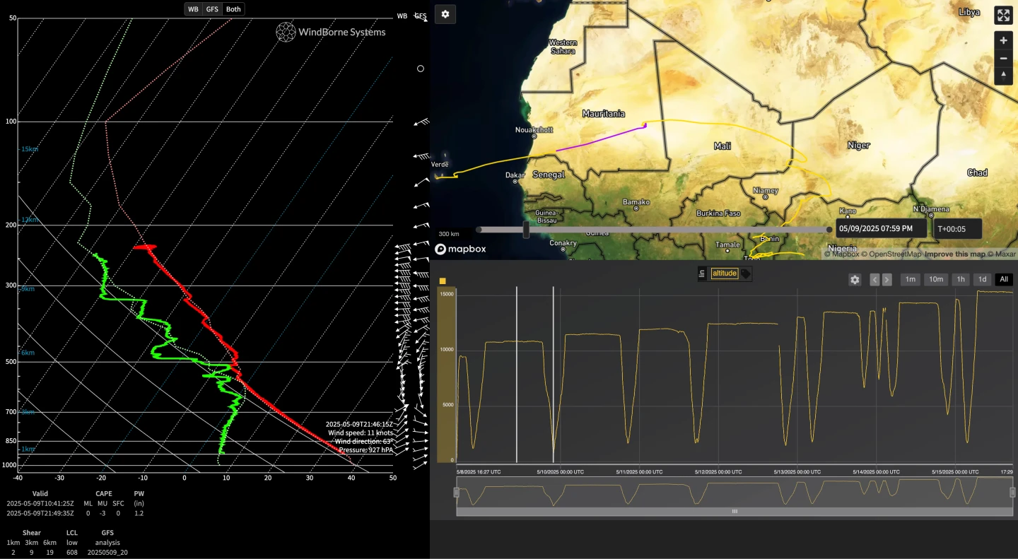
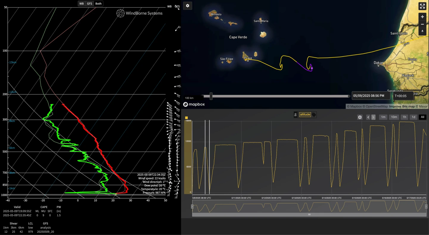
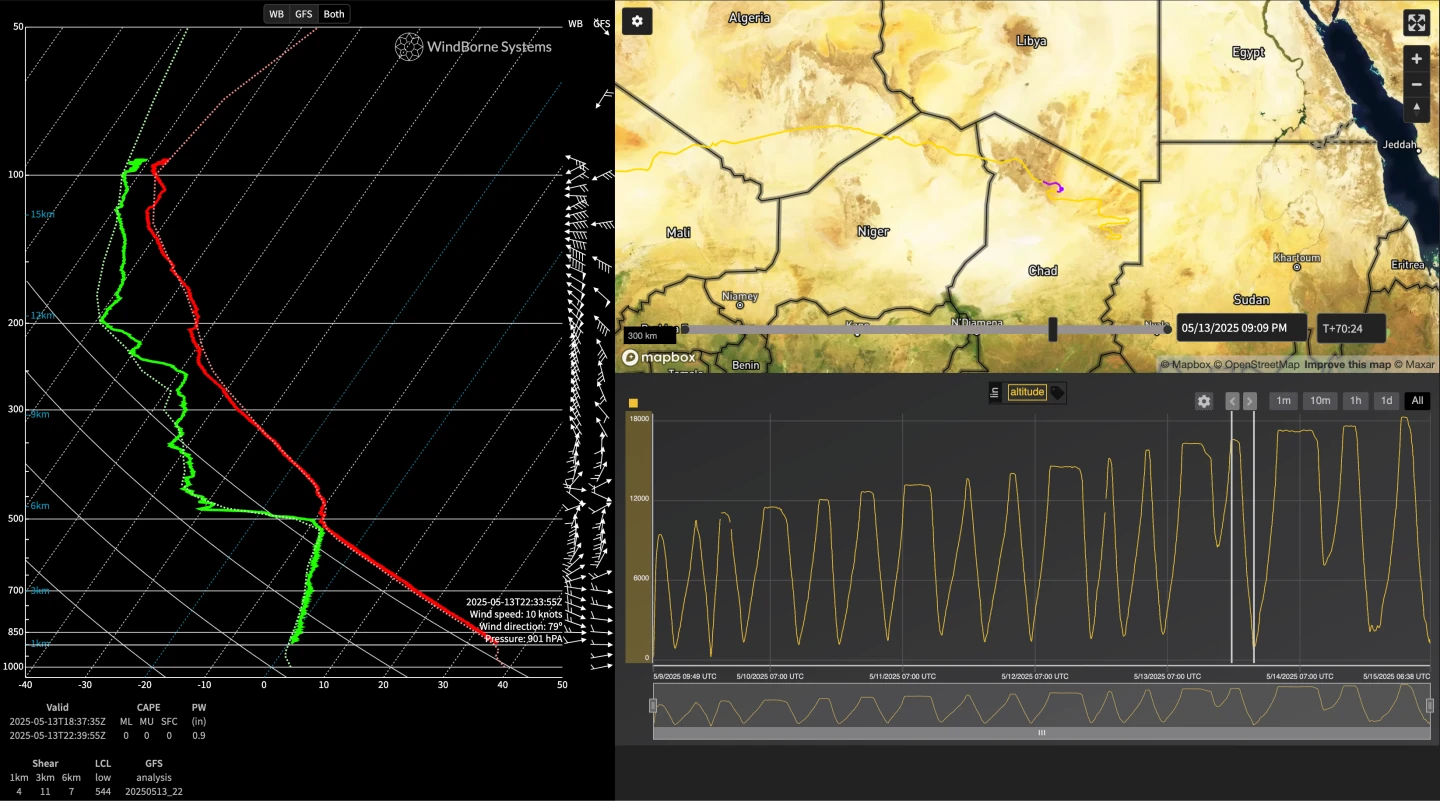
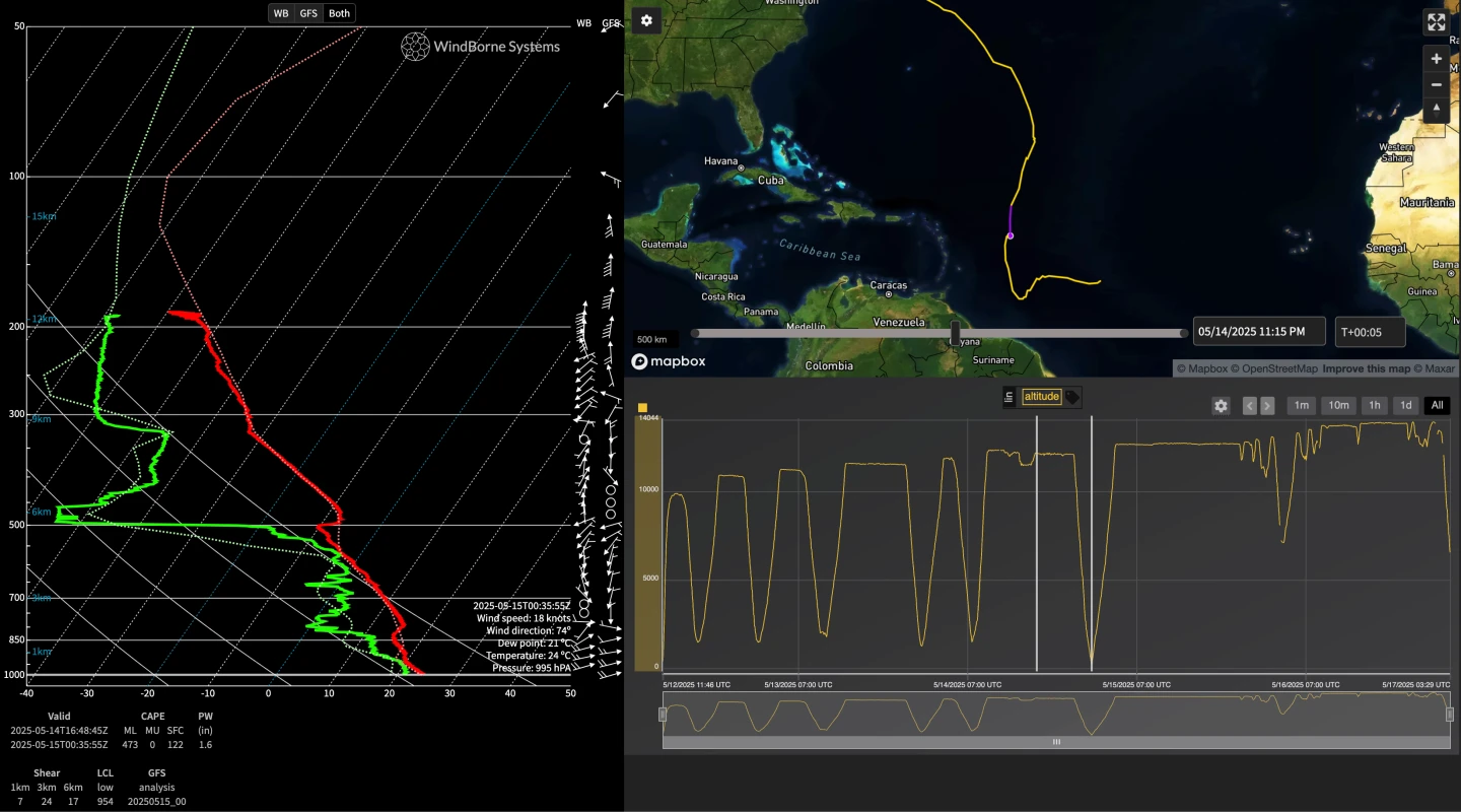
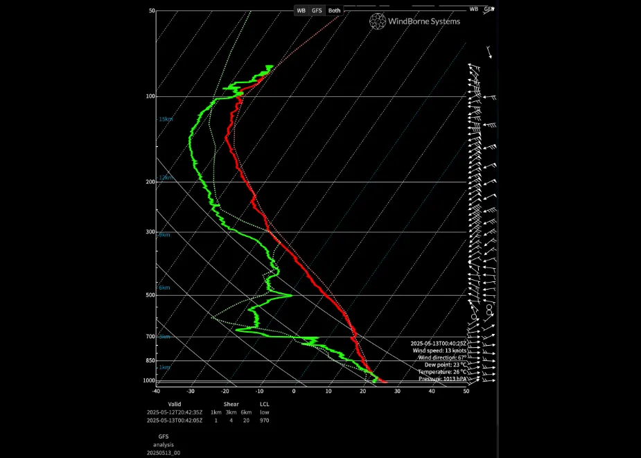
Here’s a sample of some of our deep atmospheric soundings just from the last two weeks, from all over the globe:
| FLIGHT | FIGURE | STARTING LOCATION | SOUNDING LOCATION | SOUNDING DEPTH AGL |
|---|---|---|---|---|
| W-2799 | Fig. 1 | Alaska | Turkmenistan | 174 m |
| W-2800 | Fig. 2 | Alaska | Western Pacific | 499 m |
| W-2808 A | Fig. 3 | New York | Eastern China | 446 m |
| W-2808 B | Fig. 4 | New York | Pacific | 44 m |
| W-2859 | Fig. 5 | Palo Alto | Pakistan | 112 m |
| W-2861 | Fig. 6 | Alaska | Russia | 119 m |
| W-2865 | Fig. 7 | South Korea | Eastern Pacific | 590 m |
| W-2878 | Fig. 8 | Cape Verde | Mauritania | 294 m |
| W-2884 | Fig. 9 | Cape Verde | Cape Verde / Atlantic | 249 m |
| W-2886 | Fig. 10 | Cape Verde | Chad | 330 m |
| W-2890 | Fig. 11 | Alaska | Nova Scotia | 14 m |
| W-2907 | Fig. 12 | New York | Caribbean | 196 m |